Cebu · Moalboal Sardine run · Pescador wall
Sardine-run drift dives and Pescador Island walls. Mark the entry, track drift distance in real time, return to the boat with confidence.
No extra hardware·No subscription·Underwater nav on your wrist.
A complete real-time underwater navigation system that runs on your Apple Watch Ultra. Dual-band GPS on the surface, sensor fusion (magnetometer · pressure · IMU) underwater — bearing and distance never drop.

No receiver, display or dedicated unit to buy. The Apple Watch Ultra already on your wrist is your nav computer, compass and map.
No monthly or annual fees. One purchase covers every navigation feature and the logbook for life. Sync happens through your own iCloud account.
Depth, dive time, NDL and ascent rate sit right on the navigation screen — supplemental safety info from a certified depth sensor.
On the surface, the Apple Watch Ultra's dual-band GPS locks in your entry point. Once you descend, magnetometer, pressure and IMU readings are fused through an Extended Kalman Filter (EKF) to estimate bearing, traveled distance and depth — continuously, with no signal required.
Any single sensor is brittle. Magnetometers drift near metal. Pressure shifts with current. IMU integrates error over time. Ocean MAP combines all three through an Extended Kalman Filter so each one's weakness is covered by the others.

Depth, NDL, ascent rate and real water temp on one screen. In deco it prescribes stop depth, time and TTS — with nitrox MOD and a CNS oxygen clock.

Depth, heading, distance and actions in a 6-cell cockpit grid. R (start) and waypoints stay locked to their bearings on the dial — the current target blinks to guide you.

The map rotates like a compass (heading-up), so your direction of travel is always up. Mark the entry, track underwater, follow the dotted line home — one flow.

Divers don't hold still — you wave, you signal, and every diver's kick is different. Ocean MAP reads that motion and recalibrates to you on every dive.
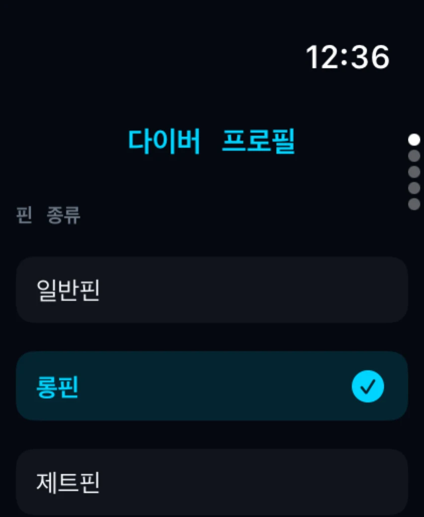
Gyroscope and gravity sensors tell a deliberate compass sighting from hand motion, and gyro and magnetometer cross-check in real time so a twisted wrist never lets heading error accumulate. Distance advances only on each fin kick, so your position never drifts while you hold still. Sight steady and you get a confirmed, accurate reading.
On surfacing, the GPS entry↔exit displacement is compared with the underwater track to learn your fin-kick stride. Distance estimates converge to you over dives — all on-device.
Fin type and dive style (relaxed · balanced · aggressive) set your initial stride, and kick patterns auto-detect your style — so you start close to your true value from dive one.

The pressure sensor measures depth in 0.1m increments. Auto-detection picks up dive start and end with no manual input. NDL, ascent rate and water temperature are computed in real time — no setup required.
Dives auto-logged on the Watch sync via iCloud and open up as logbook entries, a site map and statistics on iPhone. CSV export and notes are not paid extras.
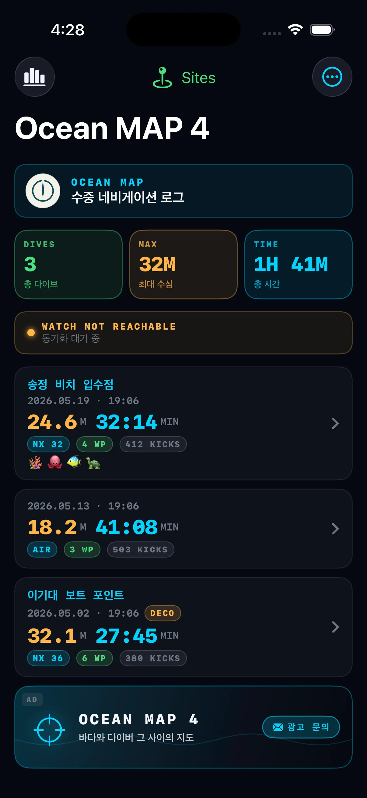
Total dives, max depth and accumulated time as cards. Recent dives sorted chronologically.
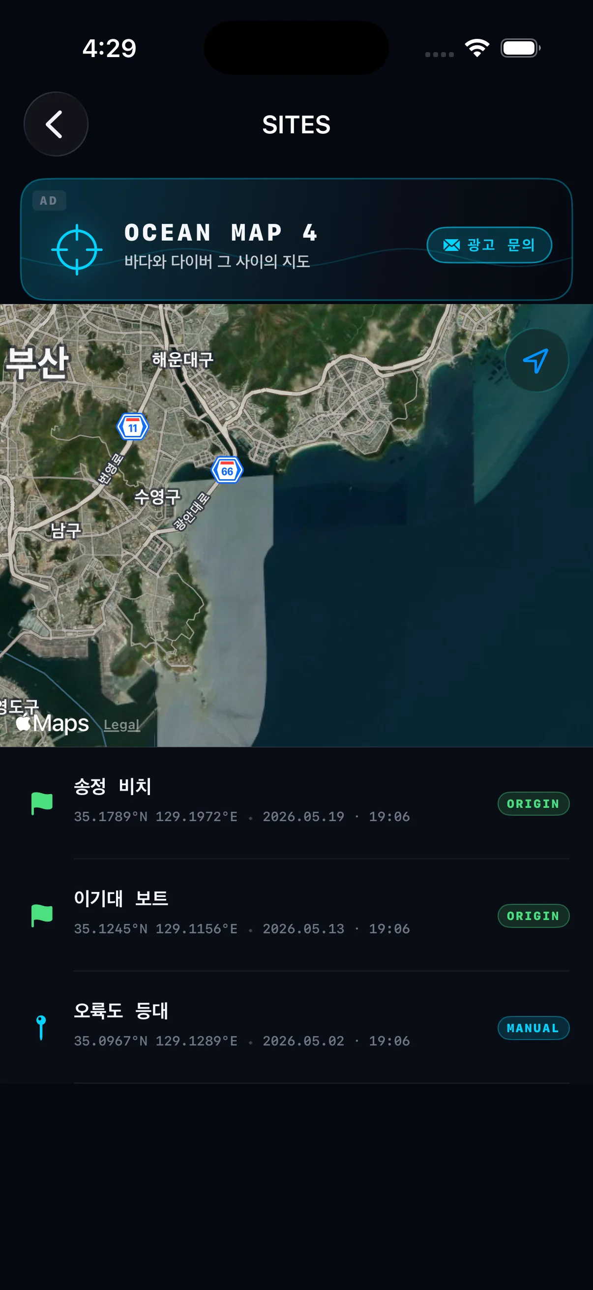
Entry points captured automatically; points of interest marked manually. Coordinates and dates stored together.
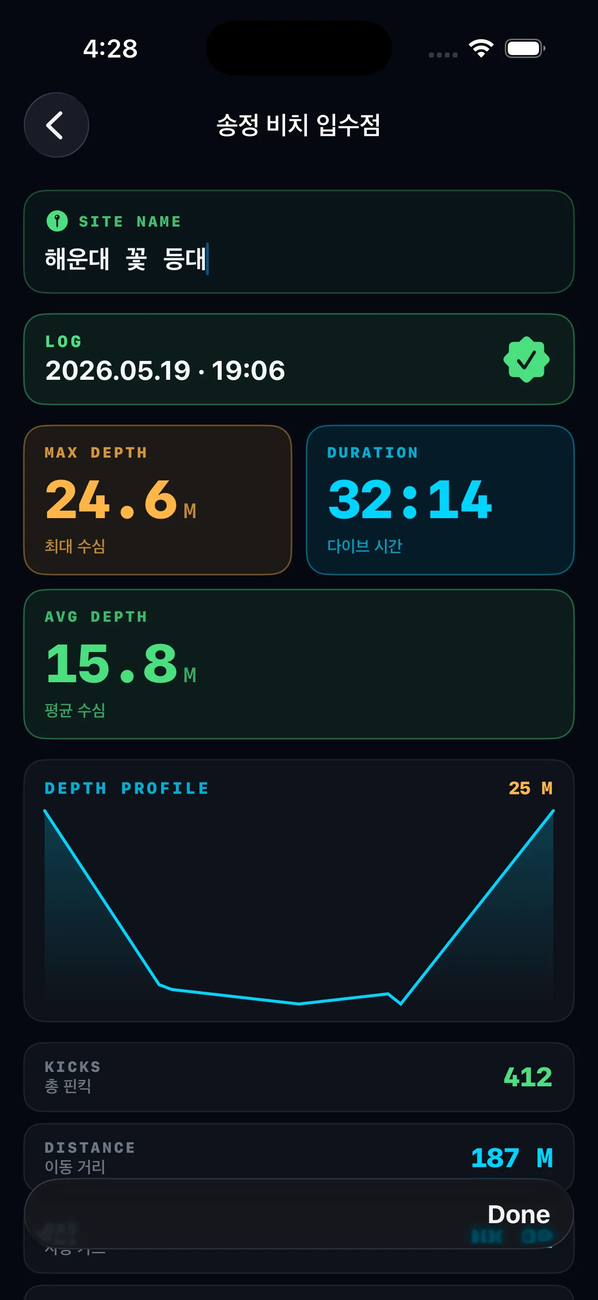
Max and average depth, dive time, kick count and traveled distance on a single page.
While Ocean MAP guides you safely underwater, your track — anonymously — joins a global underwater chart. The next diver enters that site already knowing it, incidents drop, and the whole diving industry grows together. 3,885 dive sites are already registered.
Sensor fusion finds the way where GPS can't reach — underwater.
With your consent, route & entry point become a piece of the chart.
Understand a new site from the chart before you even enter.
Fewer incidents, lower barriers, more divers worldwide.
Strong currents, deep wrecks, atoll mazes — sensor fusion adapts to the navigation challenge each site presents.
Sardine-run drift dives and Pescador Island walls. Mark the entry, track drift distance in real time, return to the boat with confidence.
Jackfish tornadoes and steep wall dives. At depth the magnetometer holds your bearing back to the entry point even as the wall drops away.
The USS Liberty wreck and coral garden. At 30m on the hull, glance at your wrist for the exit heading and ascend along the safest route.
Manta Point and Crystal Bay drifts. Cumulative travel distance during the drift estimates the recall distance for the boat.
Narrow channels through coral mazes. GPS remembers your entry coordinates, and after ascent the watch points you back to the boat.
Strong-current dive sites at White Rock and Elephant Head Rock. The EKF estimates surface-recovery distance after a drift dive ends.
Corner dive with sharks and mantas in heavy current. IMU compensates for posture shifts so the bearing stays stable when the flow grabs you.
Channel drifts and manta cleaning stations between atolls. Even when the boat falls out of sight, GPS marking and magnetic navigation bring you home.
Liveaboard wreck dives at Salem Express and Salama. Vertical navigation and deck-by-deck position tracking are the difference between safe and lost.
A reef complex large enough to get genuinely lost in. Map the site and pin your entry by GPS — finding a safe ascent point becomes a glance, not a guess.
Pelagic sites for whale sharks and hammerheads. Aggressive current and low visibility demand a fused bearing you can trust through every gust.
Home sites for Korean divers. Korean language UI, KST timestamps, and a built-in database of domestic dive locations.
The sites above are illustrative. Ocean MAP is sensor-based, not location-based — it works at any dive site where magnetic field and pressure can be measured.
Ocean MAP is getting ready for its App Store launch. Dual-band GPS on the surface, magnetometer · pressure · IMU sensor fusion underwater — a true real-time underwater navigation system, with depth and NDL shown as supplemental safety info from a certified depth sensor, all on a single watch.
⚠ Ocean MAP is a supplemental dive tool. Depth, NDL and ascent-rate readings are for reference only and are not a substitute for a certified dive computer. Always dive with certified equipment.
The questions divers ask most often.
No. Ocean MAP is a supplemental tool and is not certified to EN 13319 or equivalent standards.
Always wear a certified dive computer alongside Ocean MAP. Our NDL, ascent rate and depth readings are for reference only — they cannot serve as the final basis for dive planning or decompression decisions.
Right now we focus on polishing the navigation (compass · map tracking) features. Dive-computer certification is on the post-launch roadmap.
Yes — Ocean MAP requires Apple Watch Ultra (1, 2 or 3). It will not run on standard Apple Watch (Series 9 / 10, etc.).
Three hardware requirements drive this:
Right before descent, GPS captures your entry coordinates on the surface. Underwater, three sensors estimate position:
An Extended Kalman Filter (EKF) fuses all three so each sensor's weakness (magnetometer near metal, IMU drift over time, pressure affected by current) is corrected by the others. The return distance and bearing to your entry point are computed by the same model.
Field-test numbers (avg. of 10 × 20m dives):
Distance error grows with dive time and total travel due to IMU drift accumulation. Each surface re-acquisition of GPS resets accumulated error.
Note: navigation data is advisory only. Always defer to the dive site's safety procedures and your divemaster's instructions.
The biggest difference: navigation is built-in by default.
Dedicated dive computers still lead on raw sensor precision and ruggedness. Ocean MAP serves as their navigation supplement — specialized in position tracking and entry-point return.
No — iPhone is not required during the dive. All core features (compass, map tracking, depth & safety info) run entirely on the Apple Watch Ultra.
iPhone comes into play after the dive: logbook, site map, statistics and notes. iCloud sync is automatic — leave your phone on the boat.
Yes — one purchase, lifetime use. No monthly fee, no annual fee, no in-app purchases.
Pricing:
Sync goes only through your own iCloud account. There is no server-side subscription model.
Ocean MAP is currently getting ready for its App Store launch. Launch dates and updates drop first on Instagram @oceanmap4.
Once it's out, you can install it straight onto the Apple Watch Ultra you already own.
Ocean MAP supports 7 languages end-to-end: English · Korean · Japanese · Chinese (Simplified) · Spanish · German · French.
The app follows your Apple Watch / iPhone system language automatically, and you can switch in-app mid-dive.
Ocean MAP has no account sign-up and no server account. Your personal data stays on your own devices.
See the Privacy Policy for full details.
Didn't find your answer? Reach out at oceanmap44@gmail.com.